
I have noticed how quickly neighborhoods change when new housing and roads arrive. Traffic spills onto side streets, and drainage problems affect more homes. Decisions made project by project can add up to a city nobody planned for.
I have come to see that long-range planning must allow uncertainty. Population forecasts and climate projections offer clues, but cannot tell a city exactly what life will look like in 2040. Scenario-based urban planning for sustainable city growth lets planners test futures before committing land and infrastructure.
What Scenario-Based Urban Planning Actually Means
Scenario-based planning compares plausible futures and asks what each means for residents, businesses, infrastructure, and the environment. Rather than treating one forecast as a promise, planners build scenarios around different assumptions: population may rise faster, transit use may increase, or flooding may rule out construction in certain areas.
Scenarios are not predictions; they test choices. An exploratory scenario extends current patterns. A normative scenario starts with a goal, such as lower emissions, then works backward to identify needed policies and investments.
Why Cities Need More Than One Growth Forecast

Cities make decisions that last for decades. A highway interchange, water plant, housing district, or rail line can shape development long after approval. Relying on one forecast leaves communities exposed when population, prices, technology, or climate conditions shift.
Comparing scenarios reveals trade-offs early. Low-density growth may look cheaper but requires longer utility lines, more driving, and more land. Compact development can support transit and preserve open space, but needs good design, schools, affordable homes, and accessible parks. Models give decision-makers a shared basis for weighing outcomes.
How Planners Build and Compare Urban Growth Scenarios
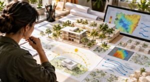
Start with a baseline. Planners choose a base year, gather land-use and population data, and set a horizon such as 2040 or 2050. They define assumptions about housing, jobs, transportation, water, and climate hazards. These assumptions matter: small changes in growth or household size can produce different maps.
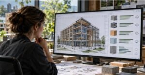
GIS, satellite imagery, demographic projections, and land-use models show where growth could occur. Some cities use digital twins to connect real-world data with simulations. These tools compare transit-oriented development, edge expansion, or limits on building in flood-prone areas. Their value depends on sound data and transparent assumptions, so uncertainty should be documented rather than hidden behind polished maps.
Measure outcomes that residents can feel
Indicators should connect analysis to daily life. Measures include housing costs, commute times, transit access, air quality, tree canopy, green space, infrastructure costs, and homes exposed to hazards. No single score captures sustainability; cities should assess several measures and explain competing priorities.
Balance Housing, Infrastructure, and Climate Resilience
Growth affects systems often planned separately. New housing needs roads, water, energy, schools, and emergency services. Building in a floodplain or water-stressed area can conceal future public costs behind a low land price. Scenario testing compares safer sites, infrastructure upgrades, and development limits before choices become difficult to reverse.
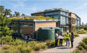
Climate risks should shape scenarios from the start. Cities can map flood exposure and heat vulnerability, then test green infrastructure, shaded streets, wetlands, or drainage upgrades. Coastal communities may model sea-level rise; hotter inland cities may prioritize tree cover and cooling access. Responses should fit local conditions.
Transport and land use also need joined-up planning. Homes near frequent transit can reduce car dependence only when service is reliable, routes reach jobs, and fares are manageable. Walking and cycling networks, safe crossings, and mixed-use neighborhoods make short trips practical and give households alternatives to driving.
Make Sustainable Growth More Equitable

Citywide averages can hide unequal outcomes. A transit corridor may improve access while raising nearby rents. A park can reduce heat yet offer little to residents who cannot reach it safely. Planners should examine who benefits, who bears costs, and who risks displacement under each scenario.
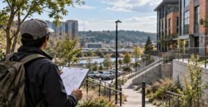
Include residents early, especially people often left out of planning meetings. Workshops, neighborhood walks, surveys, and accessible maps can reveal barriers that datasets miss. Measure housing affordability, essential-service access, pollution exposure, and public investment. Equitable urban development in rapidly growing cities depends on treating these outcomes as core measures, not add-ons after a scenario is selected.
Turn Scenario Results Into Real Planning Decisions
A scenario has little value if it sits on a shelf. Governments can connect preferred outcomes to zoning, capital improvement plans, transit, housing, conservation, and emergency management. Each action needs an owner, timeline, budget, and progress measure.
Plans should remain flexible. Cities can review indicators regularly and revisit assumptions when new data, storms, migration, or funding changes alter the picture. Data-driven land use planning under climate change works best when evidence informs decisions and monitoring prompts adjustments.
FAQs: Scenario-Based Urban Planning for Sustainable City Growth: From Forecasts to Action
1. What is scenario-based urban planning?
It is a planning method that compares multiple futures to understand how different policies, growth patterns, and climate conditions could affect a city. Planners use the results to weigh options, prepare for uncertainty, and explain why a particular investment or land-use decision makes sense.
2. How does scenario planning support sustainability?
It helps cities compare effects on emissions, land consumption, transportation, green space, housing, infrastructure costs, and exposure to climate hazards before committing to long-term decisions. It can also reveal conflicts between goals, such as adding homes while protecting flood-prone land.
3. What data do planners need?
Inputs include population and employment projections, land-use maps, housing information, transportation networks, environmental data, infrastructure capacity, and climate-risk assessments. Check data quality and share assumptions so residents understand the results.
4. Can smaller cities use scenario planning?
Yes. Smaller communities can begin with a few clear alternatives, local maps, public workshops, and indicators. They do not need an expensive digital twin to compare choices and identify priorities. A transparent process and useful local data matter more than sophisticated software.
Why Flexible Planning Creates Stronger Urban Futures
The most useful scenario is not necessarily the most ambitious or easiest to model. It helps a community understand consequences, discuss priorities, and prepare for more than one future. Models expose hidden costs, but residents and officials must decide which trade-offs are acceptable and whose needs need protection.
Linking forecasts to budgets, land-use rules, and public participation makes uncertainty manageable. Sustainable growth depends less on a perfect map than on decisions that can learn and adapt.