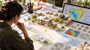

I started noticing how often city plans rely on maps that describe yesterday’s conditions. A neighborhood may look safe on an old flood map even as heavier rainfall and new pavement change where water flows. That gap between a map and lived reality is where climate-aware planning becomes essential.
I also found climate data most useful when it answers practical questions: where should housing go, which streets need shade, and what land should absorb stormwater? Data-driven land use planning under climate change connects these decisions with evidence, helping communities weigh growth against future risks.
Why Land Use Planning Needs a Climate Perspective
Land-use decisions can shape exposure to climate hazards for decades. Approving housing in a flood-prone area, replacing wetlands with parking lots, or placing essential services far from reliable transportation can create risks that are expensive to reverse. Climate change adds pressure because past weather patterns no longer provide a complete picture of future conditions.
Hazards vary by location. Coastal towns may face sea-level rise and storm surge, while inland neighborhoods experience flash flooding, heat, drought, or wildfire smoke. Planning must consider both the threat and the people, buildings, roads, and services exposed. A risk map is more useful when it shows who may be affected and what resources they can access.
The Data Behind Climate-Responsive Planning

Geographic information systems (GIS) combine information on a shared map. Planners can layer elevation, drainage networks, satellite imagery, building footprints, tree canopy, census data, and infrastructure locations. Climate projections help show how hazards may change.
Remote sensing tracks land cover and surface temperature, while sensors and local records can reveal heat hotspots or drainage problems. Predictive models test how development might affect runoff, green space, and travel access. Results depend on data quality, sound assumptions, and regular updates. Dashboards cannot fix flawed data.
Turning Climate Evidence Into Better Land Decisions
Reduce exposure before building
Climate risk maps help officials compare development sites before approving permits. For a parcel in a floodplain or wildfire interface, planners can evaluate alternatives, require protective design, limit uses, or preserve open space. Plan before investing.
Put green and blue infrastructure where it helps
Trees, wetlands, rain gardens, permeable surfaces, and retention parks can cool neighborhoods and manage stormwater. Spatial analysis can locate priority areas, including hot blocks with little shade or places where runoff overwhelms drains. Maintenance matters: a park offers limited protection if its soil cannot absorb water or its trees cannot survive local conditions.
Test scenarios before committing resources
Scenario modeling lets planners compare possible futures. A city might test whether housing near transit, stream restoration, or changed parking rules could reduce emissions while improving access to jobs and green space. DemoLand, a prototype developed with Newcastle City Council and the UK Geospatial Commission, uses machine learning to estimate effects on air quality, house prices, and access to opportunities. Such tools inform judgment; they do not replace it.
Connect Land Use, Mobility, and Community Knowledge
Land use and transportation are linked. When homes, schools, jobs, and shops are far apart, residents have fewer alternatives to driving. Compact, mixed-use development near reliable transit can shorten trips and support lower-emission travel. Urban mobility planning for low-carbon cities complements climate-informed land decisions by connecting location, access, infrastructure, and daily travel. Climate projections should shape these choices alongside commute patterns, household budgets, and nearby essential services locally.
The Limits of Data-Driven Planning
Data cannot remove uncertainty. Climate projections describe possible futures, not exact forecasts. Incomplete records can hide differences between renters and homeowners or between people with and without reliable transportation. Models may also reproduce biases in the data used to train them.
Local governments face staffing shortages, outdated systems, and limited budgets. Housing, transportation, water, and emergency agencies may store incompatible data. Progress requires shared standards, trained staff, privacy safeguards, and coordination across municipal boundaries. Watersheds and commuting networks rarely stop at city limits.
Equity matters. Restricting development in hazardous areas can save lives but may constrain housing or raise costs without alternatives. Communities need transparent criteria, public input, and affordable homes in safer locations. Data should show who benefits and who bears each decision’s costs.
Residents know things official datasets may miss, such as which intersections flood first, which bus stops lack shade, and which routes become difficult during heatwaves. Interactive maps and digital twins can make proposals easier to compare. Participatory urban planning using digital twins gives residents and planners a shared space to discuss trade-offs before construction. Participation must start early, with accessible maps, clear assumptions, and feedback reflected in decisions.
Make Planning an Ongoing Process

Plans should be reviewed as conditions change. Local governments can track buildings exposed to flooding, tree canopy in heat-vulnerable areas, stormwater retention, transit access, and new housing distribution. These indicators show whether policies work and where changes are needed.
Comparing several climate scenarios is equally useful. A proposal that performs well under moderate rainfall may fail during an extreme storm. Testing plausible conditions helps avoid investments that are difficult to adapt. Clear documentation lets residents understand decisions and what evidence might prompt a review.
Why Better Land Decisions Matter
Strong plans connect climate resilience, housing, mobility, and environmental protection. A road, home, park, or public facility can influence emissions, safety, affordability, and daily life for years. Data makes these connections easier to examine, but planning still depends on public priorities, local experience, and honest discussion about uncertainty. The aim is not to predict every event. It is to leave communities with more options as conditions change.
Maps can show where risks are growing. Progress means turning that knowledge into safer, fairer, more adaptable places to live.
FAQs: How Data-Driven Land Use Planning Under Climate Change Can Shape Sustainable Cities
1. What is data-driven land use planning?
It uses spatial data and climate projections to guide development, infrastructure, conservation, and public services.
2. How does GIS support climate adaptation?
GIS layers data to identify exposed areas, vulnerable populations, and potential protective measures.
3. Can artificial intelligence predict future land use?
AI estimates possible outcomes, not guarantees. Planners should check results against local knowledge and climate projections.
4. Why should residents participate in planning?
Residents identify risks datasets may miss. Early participation improves transparency and reveals how proposals affect different groups.