
Extreme heat in the Southwest, coastal flooding along the Gulf and Atlantic coasts, destructive wildfires in the West, and heavier rainfall across the Midwest are changing how American communities plan for growth. I believe cities can no longer treat these events as isolated emergencies.
They must prepare their neighborhoods, infrastructure, public services, and local economies for conditions that will continue evolving.
That is the purpose of urban resilience planning for climate change adaptation. Rather than rebuilding the same vulnerable systems after every disaster, this approach helps cities anticipate risks, protect residents, modernize infrastructure, and recover faster when disruption occurs.
What Are the Four Core Pillars of Urban Resilience?
A strong resilience plan connects four dimensions of city life. Treating them separately can create costly gaps, because a drainage upgrade will not protect residents who lack emergency transportation, affordable housing, or reliable electricity.
How Does Infrastructure Resilience Protect Essential Services?
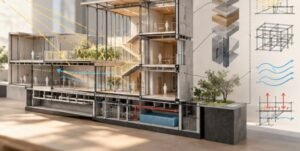
Infrastructure resilience strengthens the physical systems residents depend on every day. Cities can update building codes, enlarge stormwater capacity, reinforce bridges, elevate vulnerable utilities, modernize electrical grids, and establish distributed backup power.
Local officials should design these improvements around projected climate conditions rather than historical averages. A drainage network built for rainfall patterns from decades ago may fail under today’s intense storm cycles.
Why Is Ecological Resilience Essential for US Cities?

Ecological resilience restores natural processes within developed areas. Wetlands, urban forests, restored waterways, rain gardens, and green roofs can absorb stormwater, cool streets, support biodiversity, and reduce pressure on conventional infrastructure.
These systems often produce several benefits from one investment. A tree-lined corridor, for example, can reduce heat exposure, improve air quality, manage rainfall, and create a more comfortable walking route.
What Makes a Community Socially Resilient?
Social resilience reflects a community’s ability to prepare, respond, and recover together. It depends on trusted local organizations, accessible emergency information, affordable housing, public health resources, reliable transportation, and meaningful resident participation.
Older adults, low-income families, people with disabilities, renters, and historically underserved neighborhoods often face greater exposure and fewer recovery resources. Effective climate adaptation must direct attention and funding toward these overlapping vulnerabilities.
How Does Economic Resilience Reduce Climate Losses?
Economic resilience helps a city continue functioning after a major climate shock. Communities can strengthen it by diversifying local industries, protecting commercial districts, supporting small-business continuity plans, and ensuring that transportation, energy, water, and communications systems recover quickly.
Cities should also evaluate how climate hazards could affect employment, property values, insurance availability, municipal revenue, and supply chains.
How Should Cities Build a Climate Resilience Plan?
The most effective process moves from climate risk assessment to nature-based solutions and then to adaptive governance. Each stage informs the next, creating a flexible framework rather than a collection of disconnected projects.
Start With a Climate Risk and Vulnerability Assessment
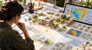
A Climate Risk and Vulnerability Assessment, often called a CRVA, combines hazard data with information about infrastructure, health, housing, income, age, and mobility. It shows not only where heat, floods, drought, wildfire, or storms may occur, but also which residents and services could suffer the greatest consequences.
US municipalities can use NOAA climate data, FEMA hazard information, local utility records, census data, satellite imagery, and GIS mapping to develop future risk scenarios. These projections should guide zoning, capital budgets, emergency management, and long-range land-use plans.
Replace Outdated Zoning With Hazard-Sensitive Regulations

Risk maps have little value unless cities use them to make development decisions. Hazard-sensitive zoning can limit dense housing, industrial facilities, hospitals, and emergency services in active floodplains, wildfire corridors, unstable slopes, or areas threatened by sea-level rise.
Cities can also encourage safer development through density transfers, conservation overlays, resilient building standards, floodplain restoration, and incentives for construction in lower-risk areas. C40 guidance similarly emphasizes using land-use policies and regulations to direct development away from high-risk locations.
Use Microclimate Modeling to Target Heat Investments
Citywide temperature averages can hide dangerous neighborhood-level differences. GIS-based heat simulations, surface-temperature mapping, shade analysis, and tree-canopy data help planners locate the blocks with the greatest heat exposure.
Officials can then prioritize cooling centers, street trees, shaded transit stops, cool roofs, reflective surfaces, and protected pedestrian corridors where they will deliver the greatest public-health benefit.
Which Nature-Based Solutions Deliver the Greatest Benefits?
Nature-based solutions and blue-green infrastructure allow cities to manage water and heat as connected challenges.
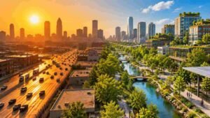
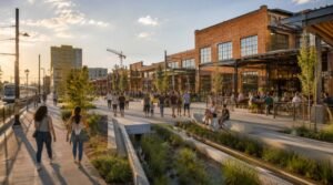
Urban blue-green networks combine parks, waterways, wetlands, green roofs, and sustainable urban drainage systems. Instead of moving rainfall away as quickly as possible, these networks slow, store, filter, and safely release water across the landscape.
Permeable pavement, bioswales, rain gardens, and infiltration areas replace sealed surfaces and allow water to enter the soil where local conditions permit. Tree-canopy expansion shades sidewalks and buildings, while green roofs reduce surface temperatures and temporarily hold rainfall.
International projects offer useful lessons for American planners. Kigali is restoring urban wetlands to reduce flood risk and improve biodiversity, while the Porte de Montreuil project is restoring vegetation and reconnecting areas around Paris, Montreuil, and Bagnolet through a greener public realm.
US cities should adapt these ideas to local watersheds, building codes, maintenance capacity, climate zones, and community priorities rather than copying projects without context.
Why Does Inclusive Governance Determine Whether Plans Succeed?
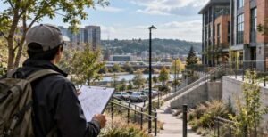
I have seen many resilience proposals presented as engineering exercises, but technical expertise alone cannot identify every neighborhood need. Residents understand recurring drainage failures, inaccessible evacuation routes, unsafe housing, transportation barriers, and locations where public information fails to reach people.
Community-led planning should begin before a city selects projects. Municipalities can work with neighborhood groups, tribal governments, disability advocates, public-health departments, housing organizations, schools, and local businesses.
Partnerships with organizations such as Habitat for Humanity can also support stronger, more energy-efficient, disaster-resilient housing. Habitat describes resilient shelter as a way to improve families’ immediate security and long-term well-being.
Cities should also use vulnerability layering to compare climate exposure with income, health, disability, housing quality, transportation access, and past underinvestment. This helps officials direct funding toward communities facing several risks at once.
Cape Town’s water-sensitive planning experience also demonstrates the value of aligning municipal systems with public behavior, local knowledge, conservation, and shared responsibility. For US cities, that may mean neighborhood water partnerships, drought communication, utility assistance, and community-designed conservation programs.
Which Tools Help Municipalities Put Resilience Into Practice?
Cities do not need to create every planning method from scratch. The GIZ Urban Climate Resilience Toolbox organizes more than 90 approaches from over 30 countries, giving practitioners examples related to planning, implementation, cooperation, and knowledge sharing.
The C40 Knowledge Hub provides city-focused guidance on nature-based solutions, heat mitigation, land-use policy, resilient buildings, and climate-responsive development. Its resources can help large US municipalities compare strategies with peer cities.
UNDP’s adaptation resources explain how local and urban actions can connect with broader National Adaptation Plan processes, climate finance, vulnerability assessments, and climate-risk-informed development.
US planners should combine these international frameworks with FEMA hazard mitigation programs, NOAA climate information, state resilience offices, local capital-improvement plans, municipal bonds, federal grants, and public-private partnerships.
How Can Cities Measure Urban Resilience?
A resilience strategy needs measurable outcomes. Cities can monitor flood losses, heat-related illness, tree-canopy coverage, affordable homes protected, drainage capacity, emergency-response times, utility outages, business recovery, resident participation, and the share of investment reaching high-risk neighborhoods.
Officials should review these indicators regularly and update projects as hazards, populations, technology, and development patterns change. Adaptive governance makes urban resilience planning for climate change adaptation an ongoing public process rather than a report that sits unused after publication.
What Climate Adaptation Mistakes Should Cities Avoid?
Cities should avoid relying on outdated weather baselines, placing critical facilities in hazardous locations, treating public engagement as a final approval exercise, and funding construction without long-term maintenance.
They should also watch for maladaptation. A floodwall may protect one district while directing water toward another. Greening projects may increase property values but displace the residents they were intended to protect. Cooling programs may overlook renters who cannot modify their homes.
Every project should therefore be evaluated for long-term risk reduction, equity, maintenance, affordability, and unintended consequences.
Frequently Asked Questions (FAQs)
1. What is the first step in urban climate resilience planning?
Cities should begin with a climate risk and vulnerability assessment that combines future hazard projections with infrastructure, demographic, housing, health, and economic data.
2. How can zoning help cities adapt to climate change?
Hazard-sensitive zoning can restrict risky development, protect floodplains, direct growth toward safer locations, and require stronger building standards in exposed areas.
3. What is the difference between green and blue infrastructure?
Green infrastructure uses vegetation and soil to manage heat and rainfall. Blue infrastructure manages water through wetlands, waterways, ponds, and storage systems. Cities often integrate both into connected blue-green networks.
4. Why is equity important in climate adaptation planning?
Climate hazards often create the greatest harm in neighborhoods with weaker infrastructure, poorer housing, limited transportation, and fewer financial resources. Equity-focused planning directs protection and funding toward these overlapping risks.
Building Climate-Ready American Communities
I see resilience as more than protection from a single hurricane, wildfire, flood, or heat wave. It is the capacity to keep housing safe, infrastructure reliable, businesses operating, ecosystems functioning, and residents connected through repeated disruption.
Effective green infrastructure planning for stormwater management supports this goal by reducing runoff, improving drainage, lowering flood risks, and creating healthier public spaces. By linking risk mapping, blue-green infrastructure, inclusive governance, economic planning, resilient housing, adaptive zoning, and measurable performance, urban resilience planning for climate change adaptation can help US communities prepare for uncertainty without sacrificing everyday quality of life.
The cities that act early will not eliminate every climate threat. However, they will make smarter investments, recover more quickly, and create safer, healthier neighborhoods for the people who face the greatest risks.